

Quinag - Sail Ghorm [Sail Gorm]
Good walks are even better shared.
NC1930 : Cloud clearing from Sail Ghorm, Quinag
Jim Barton Photo source
Overview
Quinag - Sail Ghorm [Sail Gorm]
Overview
Nestled in the breathtaking Scottish Highlands, Quinag stands proudly at 748 meters, classified as a Munro, and offers adventurers an irresistible challenge. Known for its striking geological features and stunning views, it is a must-do for hikers seeking to experience the rugged charm of Scotland.
Geology
As a mountain composed primarily of gneiss and schist, Quinag provides a fascinating insight into the ancient geological processes that shaped Scotland's landscape over billions of years. The rock formations are both intriguing and beautiful, reminding us of nature's artistry.
Routes
Quinag is renowned for its variety of hiking routes:
- Challenging Route from A894
Begin your adventure from the A894, where the ascent will take you through beautiful glens and steep paths, culminating in breathtaking vistas. It’s a trek that keeps your legs honest! - Easier Route from Inchnadamph
This route is more forgiving, leading along a lovely path by the loch. Perfect for families or those who prefer a gentler approach, this trail opens up to spectacular Highland scenery as you climb.
Summit Features
Upon reaching the summit, you'll be greeted by a proud cairn standing as a testament to the many adventurers who have conquered these heights. The panoramic views alone are worth every step taken up the rocky slopes.
Terrain
Expect a rocky terrain that has its fair share of grassy patches. Ascents can get steep, so a good pair of hiking boots is non-negotiable—unless you fancy an impromptu skid!
Views
From the summit, prepare to be amazed! Notable landmarks, including Suilven and Cul Mor, dominate the skyline. You might even find a new perspective on life, or at least a great photo to show off on social media!
- Best Seasons: Late spring to early autumn is your best bet for clear skies and splendid scenery.
Hazards
Be advised: the rocky paths can become slippery when wet. Always keep an eye on the ever-changing Highland weather conditions—you may have sunshine in one hand and a downpour in the other!
Nearby Summits
For the ambitious hikers out there, combine your adventure with nearby summits like Sail Gorm (802 meters) and Canisp (845 meters).
Access
Nearest Parking
There's ample parking available at a layby on the A894, but do arrive early to ensure a spot.
Public Transport
If you're relying on public transport, there are buses from Ullapool to Inchnadamph, though they can be a bit sparse. Plan ahead to avoid waiting longer than necessary.
Nearest Town
The nearest village is Ullapool, wonderfully located about 25 kilometers south, a perfect base for your explorations.
Facilities
Once you've conquered Quinag, treat yourself at the pub in Inchnadamph for a refreshing drink and a bite to eat. Also, public toilets are available—always a welcome sight after a long hike!
History
Name Meaning
The name 'Quinag' comes from the Gaelic 'Cnaigeach', meaning 'small hill', which is charmingly ironic given its grandeur.
Significance
This mountain is not just about physical challenge; it carries cultural significance that traces back through Highland history, weaving tales of clans and traditions.
Embrace the spirit of adventure, pack your gear, and make sure to add Quinag to your hiking bucket list! Happy trekking!
Explore routes near Quinag - Sail Ghorm [Sail Gorm]
Walks starting near this hill. Open a route to check its map, distance and full itinerary.
Ben Klibreck
View route
Loch Migdale from Torroy: Spinningdale pinewood and loch shore walk
View route
Fairy Lochs Liberator Wreckage Circuit
View route
Beinn Eighe Lancaster Wreckage at Coire Mhic Fhearchair
View route
Route planning notes
These notes describe possible approaches. Check a route's map and access information when planning your walk.
Classic Quinag Traverse
This route traverses all three peaks of Quinag, including Sail Ghorm. Starting from the car park on the A894 (grid ref NC233274), follow a well-defined path heading west towards the base of Quinag. Ascend to Spidean Coinich first, then continue along the ridge to Sail Gharbh. Finally, traverse to Sail Ghorm, enjoying spectacular views of Sutherland at every stage. Descend via the same route or follow the southern flank of the massif back to the starting point.
Direct Ascent of Sail Ghorm
This route focuses solely on Sail Ghorm. Begin at the parking area on the A894 (grid ref NC233274) and head west, following the path towards the Quinag massif. At the base of Sail Ghorm, leave the main path and ascend directly up its northern slopes. This is a relatively straightforward climb with grassy slopes and some rocky sections. Descend via the same route.
Circular Route via Gleann Leireag
This scenic circular route explores the southern approach to Sail Ghorm. Start from the same A894 car park and head southwest into Gleann Leireag. Follow the glen until you reach the southern slopes of Sail Ghorm. Ascend steeply to the summit, then return via the ridge route over Sail Gharbh and Spidean Coinich, descending back to the car park.
Short Ridge Walk to Sail Ghorm
Ideal for those seeking a shorter hike, this route starts from the same car park but focuses on Sail Ghorm alone. Ascend the main path towards Spidean Coinich but branch off early, heading directly for the ridge leading to Sail Ghorm. Follow the ridge to the summit and return the same way.
Wild Camping Route to Sail Ghorm
This two-day adventure involves an overnight wild camping experience. Starting from the A894 car park, ascend Spidean Coinich and traverse the ridge to Sail Gharbh. Set up camp near the bealach between Sail Gharbh and Sail Ghorm. On the second day, ascend Sail Ghorm and explore its surrounds before descending via Gleann Leireag to complete the loop.
Make a day of it, together
Find someone to share the walk with, or organise a day out along a route you like.
Photo Gallery
View all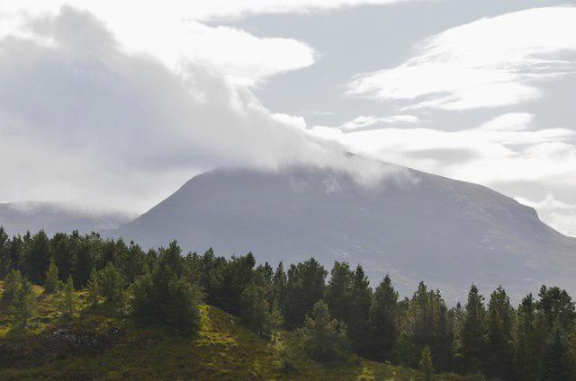 Photo could not load
NC1930 : Cloud clearing from Sail Ghorm, Quinag
Jim Barton
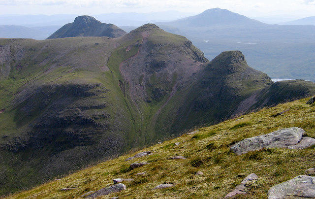 Photo could not load
NC1930 : Rocks on grassy slope of summit of Sàil Gorm
Trevor Littlewood
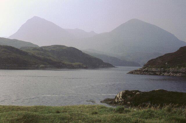 Photo could not load
NC1930 : Sail Ghorm, Quinag, from Kylesku
David Purchase
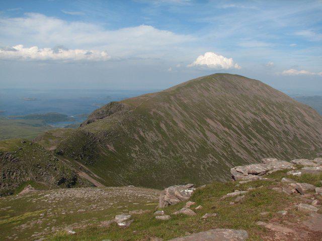 Photo could not load
NC1930 : Sail Ghorm
Callum Black
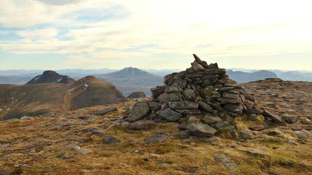 Photo could not load
NC1930 : Summit Cairn on Sail Ghorm, Quinag, Sutherland
Andrew Tryon
![NC1930 : Sàil Gorm [Sàil Ghorm], Quinag](https://cdn.walkmates.com/gallery-images/06938b9aa2484319aa284ad78b0aadbd.jpg) Photo could not load
Photo could not load
NC1930 : Sàil Gorm [Sàil Ghorm], Quinag
Rude Health
Hill facts and local notes
Classifications
Elevation
776m
2,546 ft
Prominence
158m
Coordinates
58.2256, -5.0695
NC198304
OS Map
15
Explorer: 442W
At the Summit
The summit is marked by a prominent cairn and offers panoramic views of the surrounding peaks, including the spectacular Foinaven to the north.
Terrain & Geology
Primarily composed of gneiss and schist, Quinag showcases fascinating geological formations. The rugged terrain offers a glimpse into Scotland's ancient geological history, with rocks dating back over a billion years.
Views & Scenery
From the summit, hikers can enjoy breathtaking views of the West Coast and distant mountains including Suilven and Cul Mor.
History & Heritage
Name Origin
The name 'Quinag' is derived from the Gaelic 'Cnaigeach', meaning 'the small hill', which, as they say, is quite a humble title for such a majestic mountain.
Historical Significance
In Scottish culture, Quinag is celebrated for its striking landscapes, drawing hikers and climbers from near and far, evoking tales of ancient clans and lore.
Getting There & Facilities
Parking
There is a small layby on the A894 near NC198304, where parking is available. Arrive early to secure a spot.
Public Transport
Buses from Ullapool run to Inchnadamph, though services may be infrequent. Check timetables ahead.
Nearby Facilities
Aye, there's a pub in Inchnadamph serving food and drink, as well as public toilets.
Safety Information
Known Hazards
- Steep and rocky paths may pose slipping hazards, especially in wet conditions. As always, be wary of sudden weather changes in the Highlands.
General Safety Tips
- Check weather conditions before setting out
- Carry appropriate clothing and equipment
- Let someone know your planned route
- Take a map, compass, and GPS device
- Carry emergency supplies: food, water, first aid kit, torch
Hills
Some common questions about the hills answered
Are there group walks up Quinag - Sail Ghorm [Sail Gorm]?
Many walkers use Walkmates to join or organise walks with others. You can check for group walks around Quinag - Sail Ghorm [Sail Gorm] through the maps
Are there other walkers around Quinag - Sail Ghorm [Sail Gorm]?
Activity varies by location and time, but Walkmates lets you see whether others have shared walks or shown interest in this area. Find other people through the walking friends search walking friends for Quinag - Sail Ghorm [Sail Gorm] search or of course create your own walk for Quinag - Sail Ghorm [Sail Gorm]
Can I organise a walk to Quinag - Sail Ghorm [Sail Gorm]?
Yes. If there aren’t any walks listed already, you can create a walk and make it available for others to join.
If you're signed up to Walkmates, you can create a walk to Quinag - Sail Ghorm [Sail Gorm].
How do I find a walk up this hill?
There are often multiple ways to walk this hill, depending on experience and route preference. Walkmates helps you explore walks and routes that others have shared.
Can I suggest a new route up Quinag - Sail Ghorm [Sail Gorm]?
Yes. You can suggest or create routes to share with others. Walkmates focuses on the social side of walking, so routes are used to help people organise walks and explore areas together, rather than as detailed navigation tools or route libraries.
Other uses really appreciate knowledgeable walkers sharing their routes. Share your favourite route to Quinag - Sail Ghorm [Sail Gorm] here
The is an error or something incorrect about this hill. How do I let you know?
We always strive to keep the information on Walkmates as accurate as possible. If you find an error, please let us know through the contact form and we'll aim to correct it as quickly as possible
Community Discussion
Comments
Location
![Quinag - Sail Ghorm [Sail Gorm] location map](https://cdn.walkmates.com/hill-maps/hill-sources/1190/58.22560_-5.06952.png)
Grid reference: NC198304
View on OpenStreetMapOpens a map in a new tab, centred on the hill.
No comments yet. Be the first.